

Groundwater Zone
Acoustic return · 2.4 kHz
Patented Geodirect RSS Technology
Water • Gold • Copper • REE • Oil & Gas
97–100% confirmation rate | Zero ground impact | No permits needed
Solid minerals, including copper, iron, and other ores, uranium, gold, kimberlites, rare earth metals.
In West Africa, the majority of boreholes drilled without prior geophysical survey produce no water — or far less than expected. The cost is enormous.
From water boreholes to oil exploration — every failed drill without prior survey is unrecoverable capital. In West Africa alone, 40–60% of water boreholes miss entirely. Mineral and hydrocarbon wells cost exponentially more.
Mining, farming, and construction operations halt while teams restart the drilling process from scratch after a failure.
Direct detection of hydrocarbon deposits. Eliminates dry wells and optimizes drilling capital allocation.
Mining operations, agri-infrastructure and energy projects stall when the first drill fails. Restaffing, relocating equipment, and restarting permits costs more than the survey ever would.
Spectral identification of gold, copper, and other high-value mineral deposits to 200m+ depth.
Our groundwater survey in Ghana uses two-stage approach combines remote satellite analysis with ground-level verification — delivering bankable drilling data in 3–6 weeks.
Before committing to geophysical surveys or drilling programs, our Risk Water Report gives you a comprehensive intelligence baseline — so every subsequent decision is grounded in verified data, not assumptions.
Satellite-based Resonant Spectral Sounding scans your territory from 1 to tens of thousands of km². No site visit required. Identifies water horizons, depths and fault zones.
You receive exact GPS coordinates, depth profiles, 3D deposit models, flow estimates, and water quality forecast — everything your drilling crew needs.
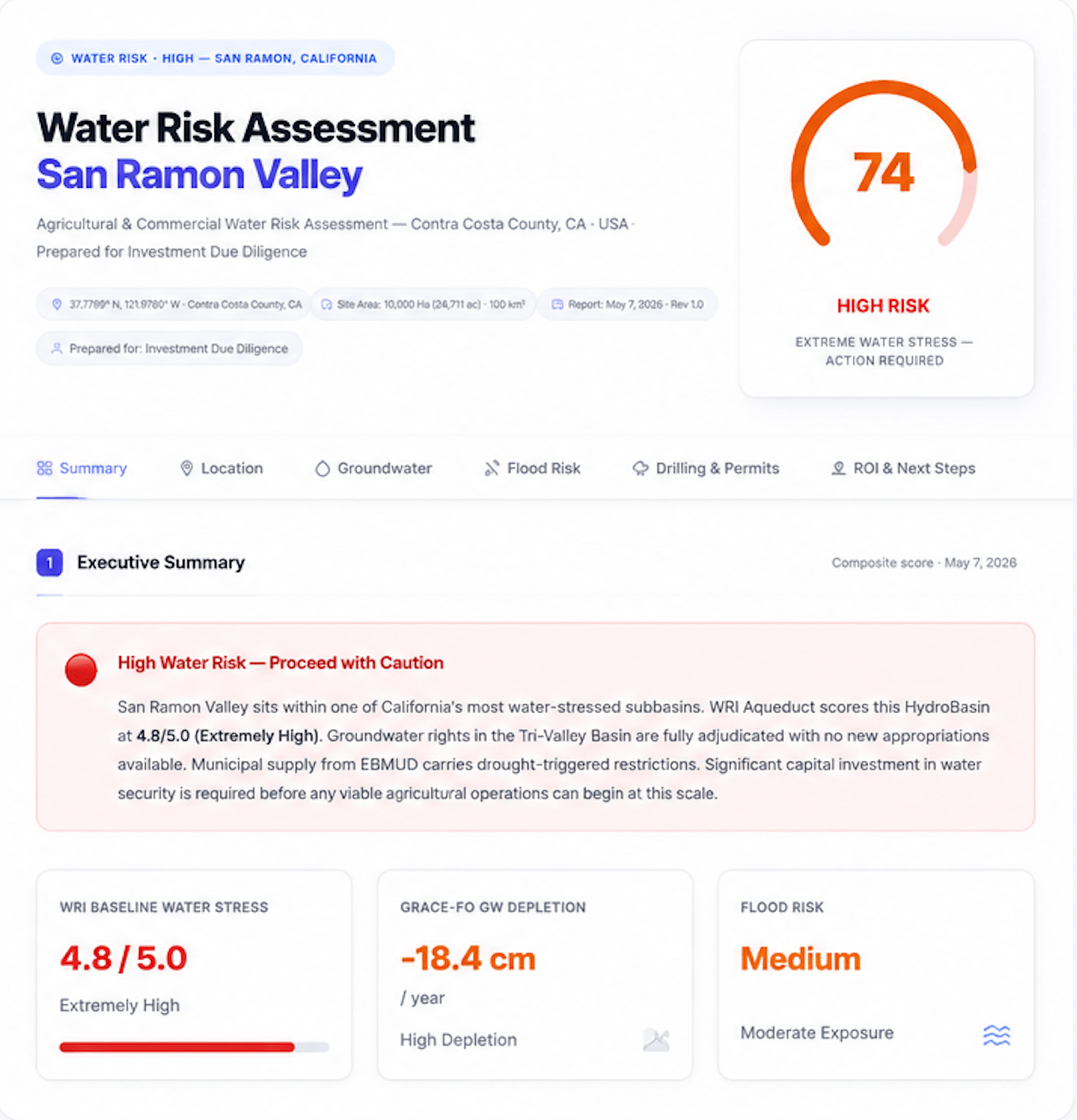
Our Water Risk Report gives you a clear, data-driven understanding of water availability, stress, and regulatory constraints—so you can evaluate land and projects with confidence.
Understand overall water risk for the property.
Review drilling permits and regulatory restrictions.
Aquifer status, depletion rates and availability.
Actionable insights for due diligence and planning.
Evaluate exposure to flooding and drought conditions.
Professional report delivered in 48 hours.
Real projects. Real wells. Confirmed by drilling — not just on paper.
Drilling results fully confirmed survey predictions. Fresh water identified where classical methods had failed.
Drilling results fully confirmed survey predictions. Fresh water identified where classical methods had failed.
Every single borehole hit water. Client saved hundreds of thousands in avoided dry wells.
Demonstrates HydroFind’s unique ability to survey offshore territories without physical presence.
Client was about to drill an empty well. Our survey identified the real deposit location before any drilling began.
Remote survey to 300m depth. Client reference letter issued confirming accuracy of all survey data.
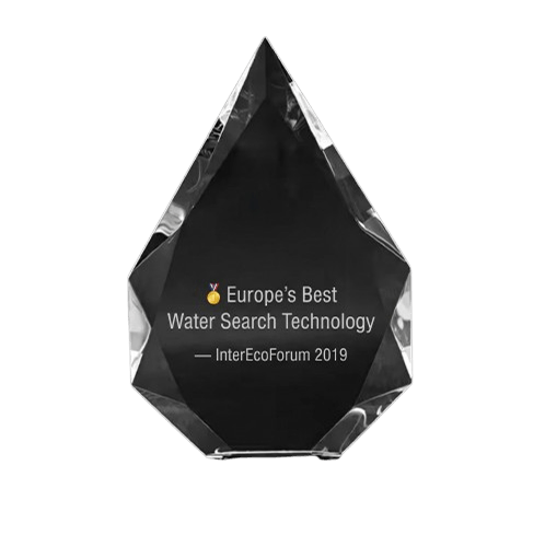
At the International InterEcoForum in Marbella, Spain — with representatives from 20 countries including UNESCO, UNWTO and UNDP officials — our team was awarded the First Prize and the honorary “Crystal Drop of Water” prize for the best water search technology in the world.
Processes analogue infrared satellite imagery using resonance effects to directly identify underground water, hydrocarbons and minerals. No seismic, no invasive work, no disruption to your operations.
On-site verification using NMR technology directly identifies water-bearing formations at precise depths. Eliminates ambiguity before you commit to drilling. Patented in Germany and Ukraine, tested in the USA.
You receive: GPS coordinates of drill points, depth columns, 3D deposit models, structural maps, horizon thickness data, water quality indicators, and predicted flow rates — in English and French.
Predicted flow
Target depth
Water type
RSS survey is conducted entirely remotely from satellite imagery. We begin analysis within days of receiving your site coordinates — no visa delays, no logistics, no disruption to active operations.
All reports, depth profiles, maps and drilling recommendations are delivered in English and French — ready for your operational team in Ghana or Guinea without translation delays. Groundwater survey Ghana
Send us your site coordinates — we'll confirm within 48 hours whether underground water is likely present, at no cost.
All surveys are conducted with complete confidentiality. Your site data and results are never shared with third parties.
Our West Africa team communicates in English and French, and responds via WhatsApp or email.
GEO Water Tech · +1 347 982 77 11
survey@geowater.tech · WhatsApp preferred
Send us your site coordinates — we’ll confirm within 48 hours whether underground water is likely present, at no cost.